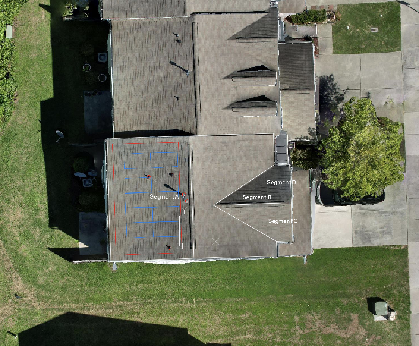
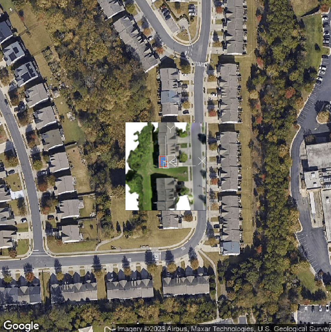
Our combined report starts with a 2D Wireframe Map, which consists of a satellite image baselayer, the Orthomosaic from the drone images above that, and finally the 2D Wireframe on top of the ortho.
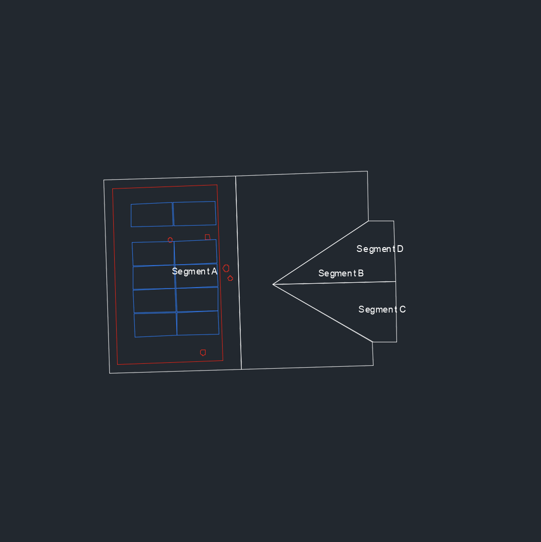
To the right of the 2D Wireframe Map is just the wireframe on its own without the ortho and baselayer.
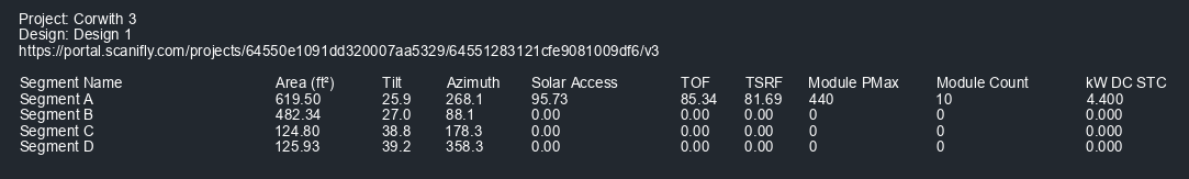
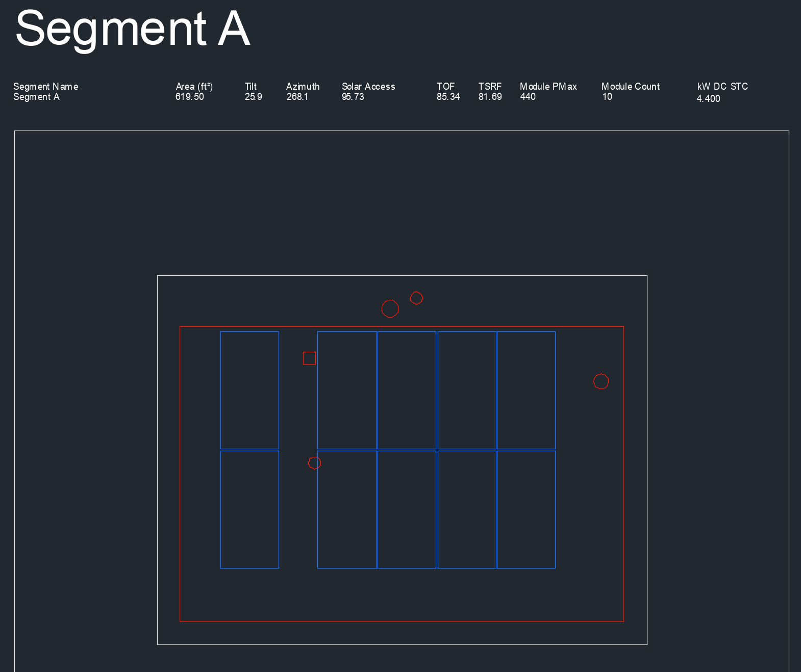
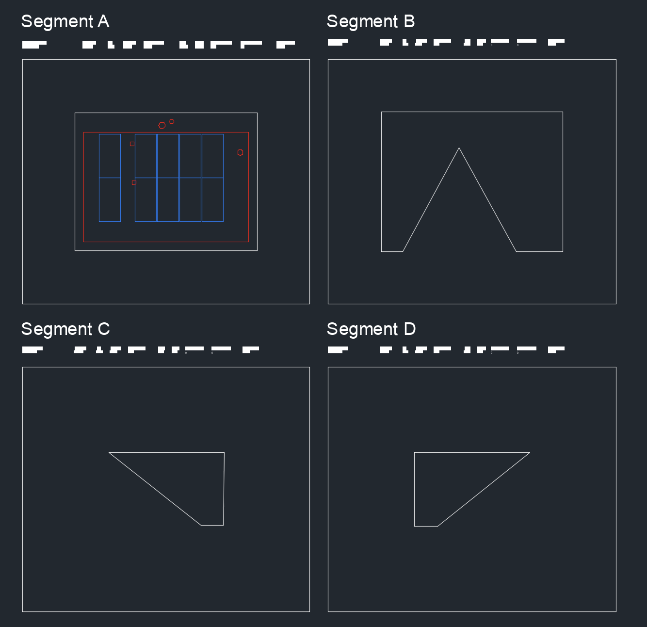
Below that, each segment is separated and labelled with area, tilt, azimuth, Solar Access, TOF, TSRF, maximum module power output, module count, and the total kW DC at standard testing conditions.
Finally, below the 2D Wireframe Map is all of the information for each segment, but listed out without the images next to them.
Just like our other CAD exports, each segment represents its own layer, which you can turn on or off within the 2D Wireframe Map.