Photogrammetry is the science and technology of obtaining reliable information about physical objects and the environment through the process of recording, measuring and interpreting photographic images and patterns of electromagnetic radiant imagery and other phenomena.
What does that even mean?!
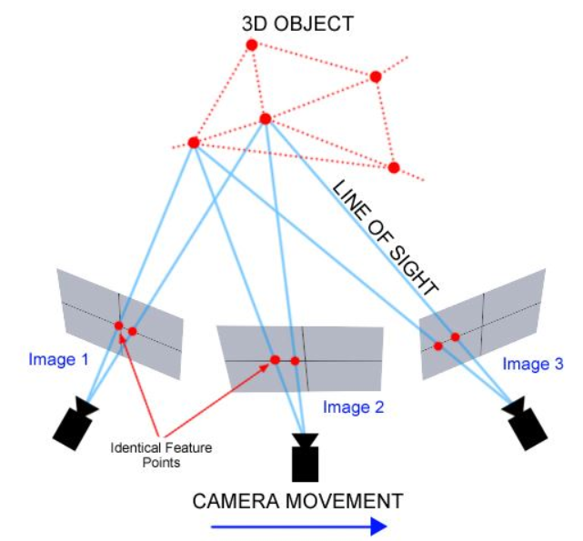
Photogrammetry is how you take 2D photos and turn them into 3D models. It uses advanced mathematics to understand how the photos are connected and recreates the scene that was originally photographed.
Source: https://thehaskinssociety.wildapricot.org/photogrammetry
In aerial photogrammetry, a camera is mounted on an aircraft. Throughout history it was common to mount cameras on all forms of aircraft but more recently the invention of drones has made aerial Photogrammetry much more common and accessible.
In terrestrial photogrammetry the camera is handheld / on a tripod on the ground. A common use for Terrestrial photogrammetry is in historical preservation of artifacts. Instead of having to fly around the subject, you can just rotate the subject itself. Terrestrial photogrammetry can also typically be used in conjunction with Aerial photogrammetry, in order to fill in areas that were not captured with Aerial photogrammetry.