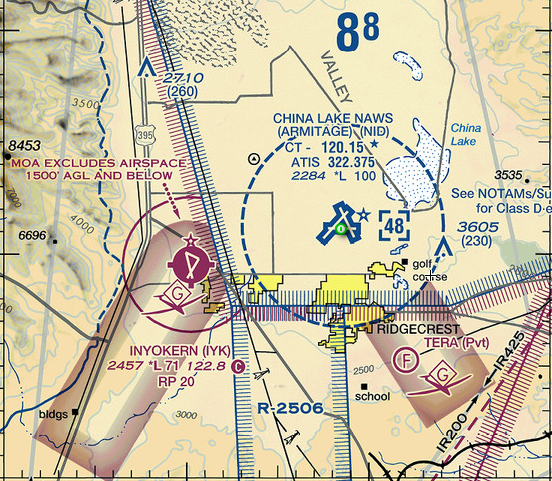
Example Aeronautical Chart
There are Class A, B, C, D, E and G airspaces, which are intended to maintain order in the sky. Airspaces are broken into different lanes in a similar fashion to how road lanes are created to direct cars.
Each type of Airspace has its own potential restrictions. In addition to the regular Part 107 Requirements. Most of the Airspace in the US is Class G, which has NO requirements other than the regular Part 107 Requirements. All other Airspaces will require some form of FAA authorization before flying at that location.
Fortunately, modern technology offers solutions to help navigate airspace regulations. Our recommended option is a mobile app called Aloft Air Control, which provides a clear representation of various airspace levels and the specific LAANC authorization heights for each zone. Additionally, this app allows users to quickly and easily obtain LAANC authorization directly through the platform.

Woah! At first this may seem overwhelming. When you understand the basics, it all comes together. Plus, there are plenty of Android and iOS and Desktop options for software that makes understanding and applying for airspace approval a breeze.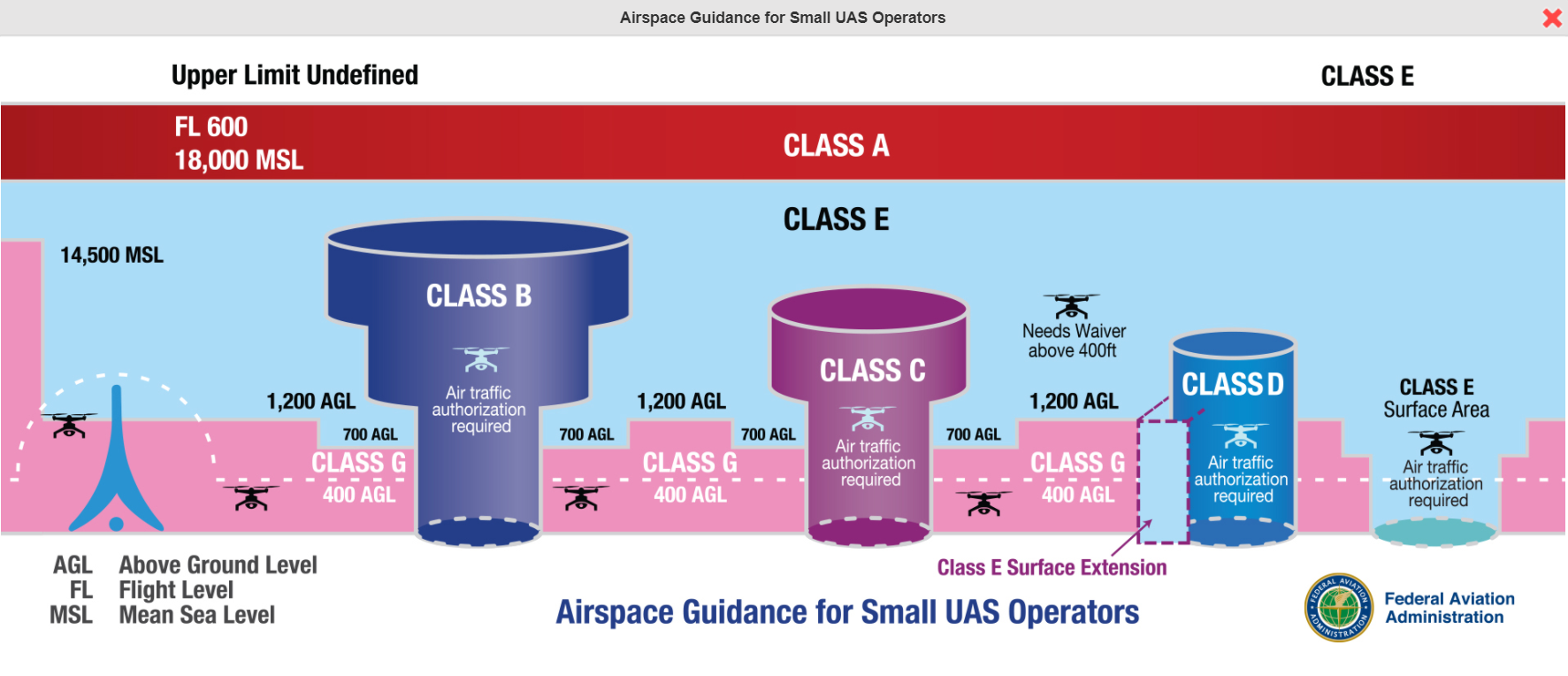
The far left side of the image, where the dotted line goes over the tower, shows a clever way to navigate different airspaces. Here you can fly within 100’ from a structure, and still remain compliant (albeit into Authorize Airspace) going above 400’.
If you plan on flying in an area with no automatic authorization, and there is no phone number listed in Airmap, please use SkyVector, which is more in-depth since it includes the aeronautical charts and a list of airports with detailed information on each airport. Best practice is to call the airport manager first before calling the tower directly. Contact info can be found in the airport chart supplement and ownership info. Please see this example.