The Common Trap: It feels like scaling a drone photo should work. You fly to 400ft, take a crisp top-down shot, and it looks like a perfect map. It is tempting to think, "I can just scale this one image and be done."
The Reality: That single image is an optical illusion. Because of perspective projection, the geometry of the roof is distorted. Scaling a raw drone image is bad practice that introduces significant user error and can lead to major design issues.
1. The Visual Proof: "The Floating Ridge"
In a raw drone photo, objects closer to the camera appear larger than objects further away.
-
The Ridge: Is closest to the drone.
-
The Drip Edge (Gutter): Is further away.
This creates a distortion where the ridge looks longer than the gutters, even on a perfectly rectangular roof. If you try to scale the raw image based on the ridge length, your gutter measurements will be wrong. If you scale based on the gutter, your ridge will be wrong.
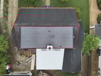

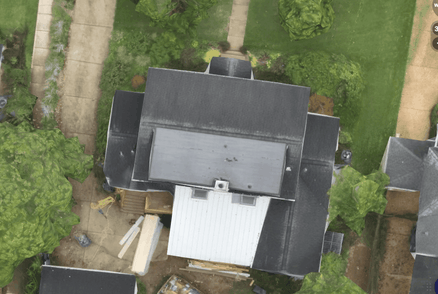
Caption: TOP: Raw Drone Image. Notice how the red outline shows the ridge appears longer than the eaves due to perspective. Bottom: Scanifly Ortho. The perspective is removed, and the lines are parallel and true to scale.
2. See the Shift (GIF)
This animation shows the simulated transition between a raw top-down photo and the corrected Scanifly Orthomosaic using the Scanifly Perspective/Parallel view toggle. Watch how the roof shape physically shifts as the software corrects the perspective.
3. Workflow Speed: Automatic vs. Manual Scaling
Beyond accuracy, there is a massive workflow difference.
The "Old Way" (Scaling a Photo):
-
Manual Risk: You have to manually draw a line on a pixelated image and tell the software "This is 10 feet." If you click the wrong pixel or your reference measurement was slightly off, the entire design is wrong.
-
Zero Integration: A raw JPG has no geographic data. You can't just drop it into other tools.
The Scanifly Way (The Orthomosaic):
-
Auto-Scaled: Because we process hundreds of images to create a 3D model, the resulting Ortho image is automatically scaled to the real world. No manual guessing required.
-
Geo-Referenced Exports: You can export the Ortho as a KMZ file directly into Google Earth or GIS apps. It lands in the exact right spot, at the exact right size.
-
CAD Ready: When you export the 2D wireframe or combined DXF to CAD, the image is already there and already true-to-size.
4. Missing Data: A Picture is Not a Model
Finally, a scaled photo is still just a flat 2D picture. It is missing the critical data that actually creates a solar design:
-
Pitch: A top-down photo cannot tell you the slope of the roof. Scanifly calculates pitch automatically from the 3D mesh.
-
Shade: You cannot run a shading analysis on a JPG. Scanifly uses the 3D geometry of trees and obstructions to calculate bankable production numbers.
-
Production: Without pitch and azimuth (orientation) derived from the 3D model, any production calculation is just a guess.
Summary
Scanifly uses hundreds of overlapping images to build a mathematical 3D model. We then generate the Orthomosaic from that model. This is why our images are maps, not just snapshots.
Please reach out to hello@scanifly.com with any questions.