Please Note
Before rendering shadows, generating viewheds, and adding modules, the 3D mapped environment needs to be geo-referenced. The steps below go over how to add location.
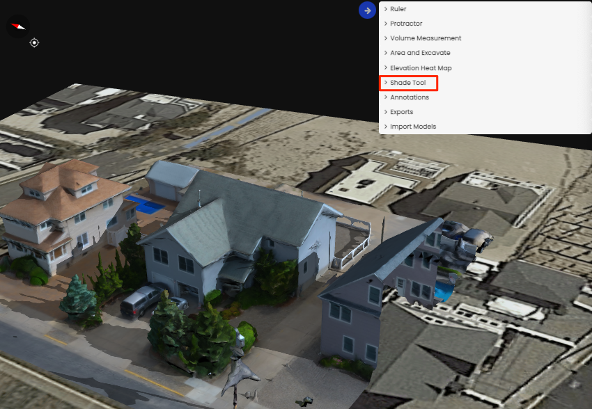
Adding Location
Select the shade tool dropdown.
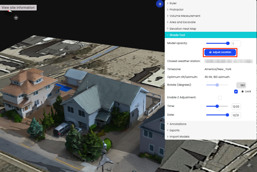
Select Adjust Location
Choose location on the map.
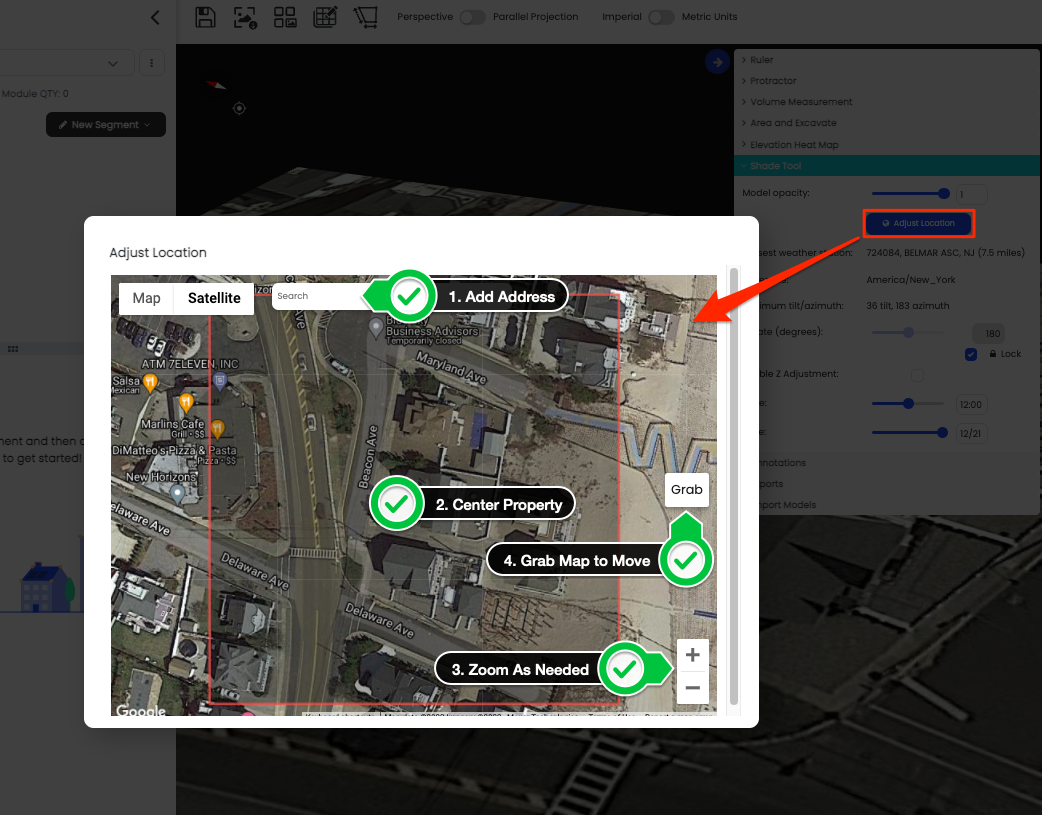
Align the model with the satellite image.
Please Note
The UTC is automatically updated. However, you can change the UTC value if needed.
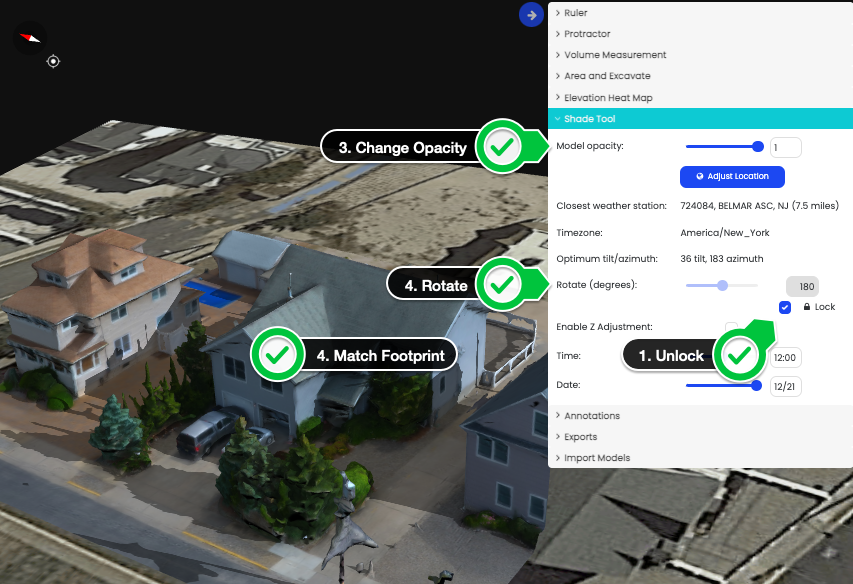
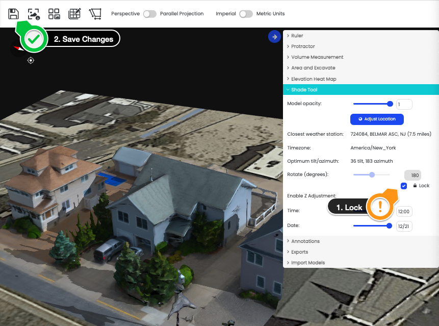
Lock the model and save changes
Please note
If the model is not locked, then saved, the model will move out of place even when modules are added.